

Изчерпано
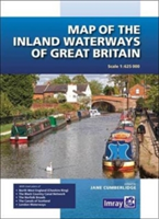
Map of the Inland Waterways of Great Britain
Изчерпано количество
SKU: 9781846238277
Weight: 0.124000
ISBN: 9781846238277
Вид корица: Paperback / softback
Издателство: Imray, Laurie, Norie & Wilson Ltd
Брой страници: 1
First published over 60 years ago when interest in reviving Britain's network of navigable and rivers was starting to gather pace, this map provides the best coverage of the system in England, Wales and Scotland. Distances, the number of locks and restricting dimensions are given for each waterway.
* Сроковете за доставка могат да бъдат удължени и по време на кампании, както и в зависимост от наличностите на поръчаните артикули.
Доставка до твой адрес
- При теб до 3 работни дни
- Цена за доставка с куриер - 4.90 лв. | 2,51 €
- Безплатна доставка
(за поръчка над 49.80 лв. | 25,46 €)
Доставка до офис на куриер
- Цена за доставка до офис - 4.90 лв.| 2,51 €
- По-кратък срок за доставка
Доставка до магазин на Orange Center
- Доставката до магазин е безплатна
Онлайн магазин orangecenter.bg уверява своите клиенти, че съгласно чл. 55, ал.1 от Закона за защита на потребителите, имат правото да се откажат / или заменят получена от тях стока в срок от 14 (четиринадесет) работни дни от датата на получаване на стоката САМО при условие, че продукта е:
- в оригиналният си вид и качествени характеристики, със запазена оригинална опаковка и етикет, като не се счита за повредена опаковката, цялостта на която е била нарушена по начин, единствено позволяващ отделянето й от стоката.
- без следи от употреба (скъсване, надраскване, счупване или други повреди), както и няма други повреди, причинени от неправилна употреба.
Повече информация за връщане и замяна на стока ще намерите тук.
The information below is required for social login
Създавайки профил получаваш
Лесен и удобен начин да пазаруваш от Orange и проследяваш история на покупките си
Необходимо е да активираш регистрацията си.
Изпратихме имейл на с линк за активация. Последвай линка, за да активираш профила си в следващите 24 часа. Имейлът би трябвало да пристигне до 1 минута.
Ако не откриваш имейл от нас, потърси го в спам директорията или провери дали посоченият имейл адрес е изписан правилно. Ако това не помогне, свържи се с нас на [email protected] 0700 20 866
Създавайки профил се присъединяваш към програмата My Orange и се съгласяваш с Правилата и условията на Ориндж Интернешънъл АД.